Wells, John G. (John Gaylord) (1821-1880) Well's new map of Missouri and Eastern Kansas
High-resolution images are available to schools and libraries via subscription to American History, 1493-1943. Check to see if your school or library already has a subscription. Or click here for more information. You may also order a pdf of the image from us here.
A high-resolution version of this object is available for registered users. LOG IN
Gilder Lehrman Collection #: GLC04174 Author/Creator: Wells, John G. (John Gaylord) (1821-1880) Place Written: New York, New York Type: Map Date: 1857 Pagination: 1 map ; 61 x 80.5 cm. Order a Copy
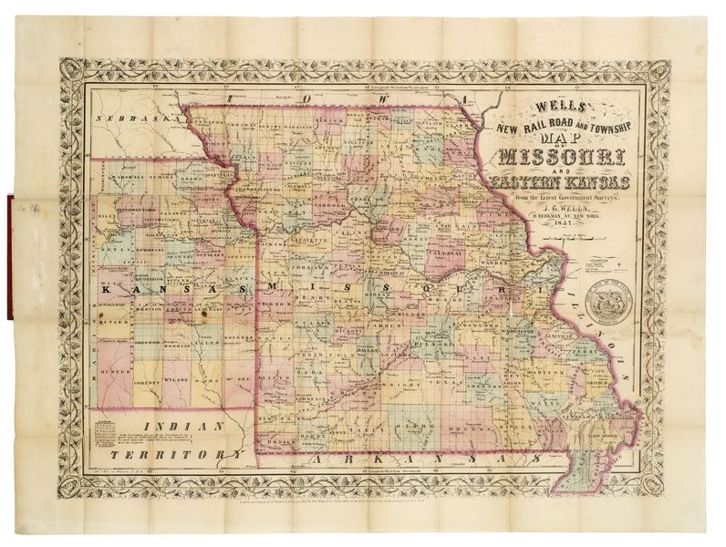
This is a fold out map contained within a book measuring 14.5 x 9 cm. When unfolded, the full title displayed on the map is "Well's New Railroad and Township Map of Missouri and Eastern Kansas from the latest Government Surveys." Contains a large image of Missouri, indicating border states. Depicts different counties in color.
Citation Guidelines for Online Resources
The copyright law of the United States (title 17, United States Code) governs the making of photocopies or other reproductions of copyrighted material. Under certain conditions specified in the law, libraries and archives are authorized to furnish a photocopy or other reproduction. One of these specific conditions is that the photocopy or reproduction is not to be “used for any purpose other than private study, scholarship, or research.” If a user makes a request for, or later uses, a photocopy or reproduction for purposes in excess of “fair use,” that user may be liable for copyright infringement. This institution reserves the right to refuse to accept a copying order if, in its judgment, fulfillment of the order would involve violation of copyright law.