by Liam Riordan
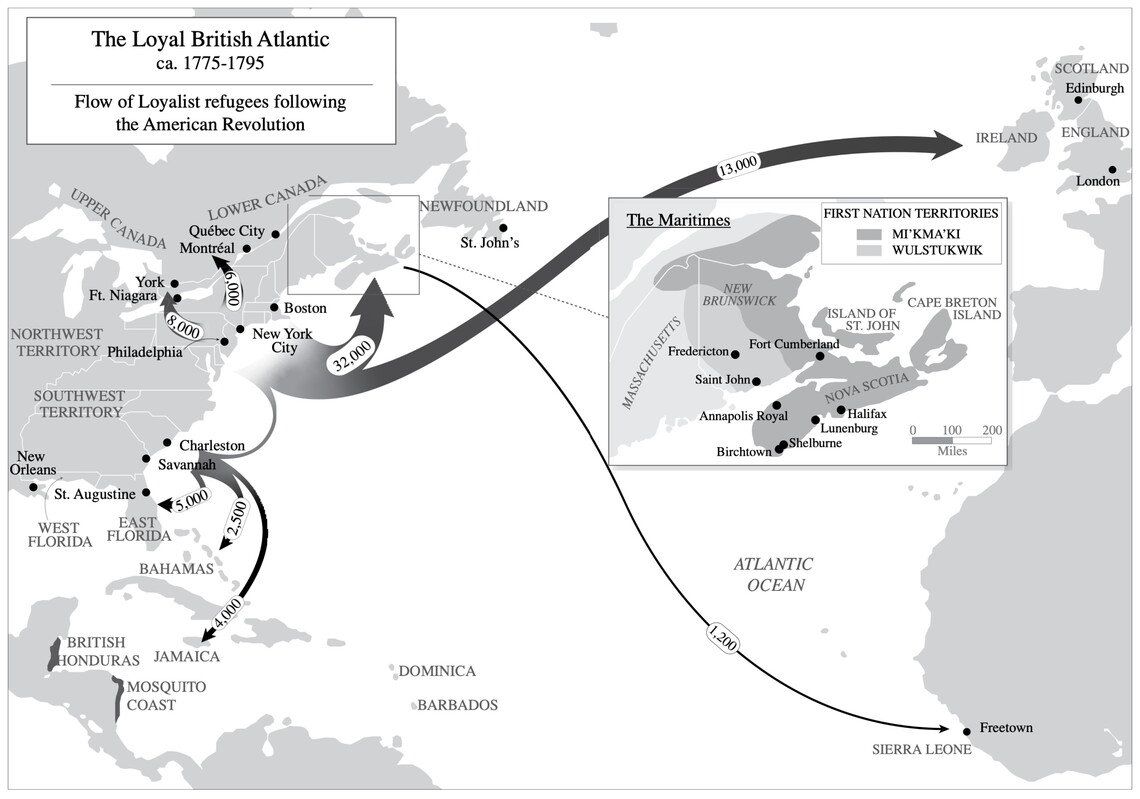
Liam Riordan, “Exile and Opportunity: Wabanaki, Acadian, and Loyalist Forced Migration in the Northeastern Borderlands of North America,” in Mobility and Coercion in an Age of Wars and Revolutions: A Global History, c. 1750–1830, eds. Jan C. Jansen and Kirsten McKenzie (New York: Cambridge University Press, 2024), Map 2.1; Jerry Bannister and Liam Riordan, eds., The Loyal Atlantic: Remaking the British Atlantic in the Revolutionary Era (Toronto: University of Toronto Press, 2012).
Discussion Questions
Look Closely
- From what geographic area did loyalist refugees most often flee?
- How many loyalist refugees moved to lower Canada?
- When loyalists moved to lower Canada, which Native nations’ territory did they enter?
Think Critically
- Most loyalists who moved to lower Canada did not speak French or Native languages. How could you find out if this shaped their options for school, housing, and work?