Self-Paced Courses: Explore American history with top historians at your own time and pace!
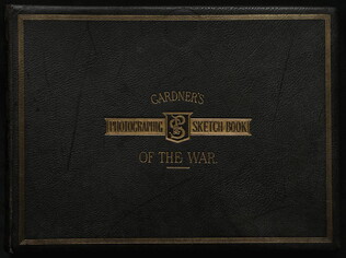
1866
Gardner, Alexander (1821-1882)
Gardner's Photographic Sketchbook of the War. 2 Vols.
These albums are in the original format, showing photographs taken while in Brady's studio. Depicts Antietam, Gettysburg, Petersburg, etc.
GLC03547
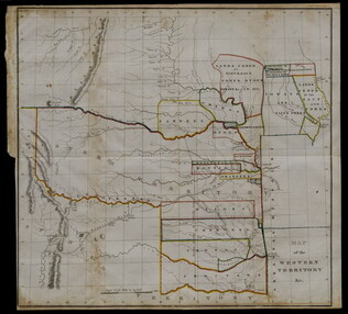
20 May 1834
United States. Congress. House.
Map of the Western Territory & c.
Large folding map of present-day Oklahoma with borders outlined in watercolour designating areas occupied by Native American tribes. Map was previously bound in back of the House Report found in 4132.01. Border lines are colored in blue, yellow...
GLC04132.02
circa 1864
Bacon & Co. (fl. 1864)
Bacon's Large Print War Map Showing 50 Miles round Washington and Richmond
Shows major towns, waterways, and railroads. Concentric circles with intervals of ten miles each surround both Washington and Richmond. A red line shows General Ulysses S. Grant's route from Fredericksburg to Petersburg, Virginia, and a blue line...
GLC04175
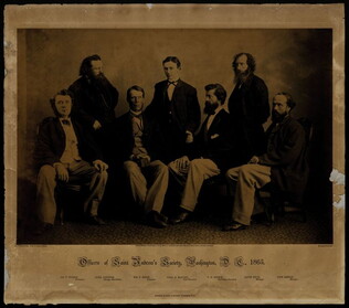
1865
Officers of Saint Andrew's Society, Washington, D.C., 1865.
One group portrait entitled, "Officers of the St. Andrew Society," photographed by Alexander Gardner dated 1865. The men photographed are, from left to right: Joseph P. Wilson, Alexander Gardner, WM. R. Smith, Fred B. McGuire, T. W. Spence, David...
GLC04186
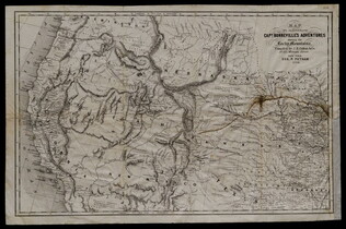
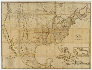
1856
Colton, J. H. (Joseph Hutchins) (1800-1893)
Map to illustrate Capt. Bonneville's adventures among the Rocky Mountains.
The map covers the western United States, with Washington, Oregon, California, Utah, New Mexico, Nebraska, Kansas, Texas, and Arkansas. Published in New York by George P. Putnam. Owned by John Moore (1826-1907), an army surgeon with the Utah...
GLC04194.01
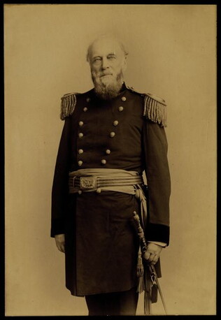
circa 1886
Bell, Charles Milton, ca. 1849-1893.
[Portrait of Surgeon General John Moore]
Three quarter length standing portrait of Surgeon General Moore in dress uniform. With rubber stamp on verso, "C.M. Bell. 463 & 465 Penna. Ave. Washington, D.C." Moore wears his dress uniform complete with epaulets, belt buckle, sash, dress belt...
GLC04196.01
1820, 1823
Melish, John (fl. 1820-1823)
A Map of the United States with the contiguous British & Spanish possessions
The 1823 edition, but copyright 1820. Of Melish and his maps, Martin & Martin write (p. 115): "Recognizing the demand for geographical information on the American West was limitless for the foreseeable future, Melish undertook to accumulate a vast...
GLC04319
1862
Abbot, Henry L. (1831-1927)
Campaign Maps Army of the Potomac, Map No. 1. Yorktown to Williamsburg [Manuscript map signed]
Title continues: "Prepared by Command of Maj. Gen. George B. Mc.Clellan U.S.A. Commd'g Army of the Potomac A.A. Humphreys Brig. Gen. and Chief of Top. Engr's." Accomplished on four pieces on joined wove paper. Photographed at the Coast Survey Office...
GLC04355.02
Campaign Maps Army of the Potomac, Map No. 1. Yorktown to Williamsburg
Title continues: "Prepared by Command of Maj. Gen. George B. Mc.Clellan U.S.A. Commanding Army of the Potomac Brig. Gen. A.A. Humphreys Chief of Top. Engrs Army of the Potomac." Engraved by W.H. Dougal. Map compiled by Abbot. Printed version of...
GLC04355.03
GLC04355.04
Showing results 1 - 10