Self-Paced Courses: Explore American history with top historians at your own time and pace!
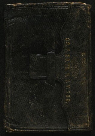
1858-1861
Beach, Elias William (1841-1921)
[Diary 1858-1861]
Contains various personal content. Covers 1858 and 1861, but skips most of the time in between.
GLC00919.23.01
1 January 1863 - 18 December 1863
[Diary 1863]
Autograph manuscript signed. Entries made from several locations, mostly from Virginia.
GLC00919.23.03
1861
Morey, Charles C. (ca. 1830-1865)
[Diary of Sergeant in 2nd Vermont Vols.]
Mentions first Bull Run.
GLC01921.01
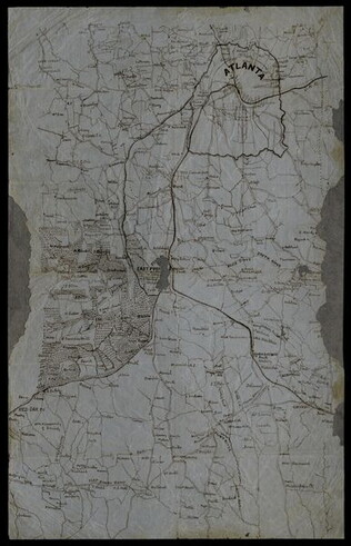
circa 1864
Unknown
[Manuscript Civil War map of Atlanta and vicinity]
Detailed map on blue lined paper of Atlanta and environs from General Sherman's Atlanta campaign. Shows roads, railroads, forests, and rivers. Directions and latitude not given.
GLC01924
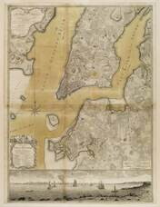
1776
Ratzer, Bernard
Plan of the City of New York in North America
Engraved by Jeffrey and Fagan. Oversize engraving showing lower Manhattan Island, part of Brooklyn and Hoboken, N.J. A cartouche extending across the bottom has a panoramic "South West View of the City of New York." Based upon the survey of 1766...
GLC02006
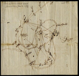
8 January 1777
[Map of roads in the vicinity of Morristown, New Jersey]
Indicates roads, some natural features, landmarks ("court house," "Whites Tavern Genl Lees," bridge, landing, etc.), outlying towns, and distance between points on the map. Indicates the location of towns surrounding Morristown. Notes the position...
GLC02437.09543
3 August 1781
Lincoln, Benjamin (1733-1810)
[Map of Charleston, South Carolina]
Manuscript map of Charleston, South Carolina showing the coastline, various rivers and geographic features, certain structures and county names. Date and creator inferred, based on the presumption that this map accompanies GLC02437.01112.
GLC02437.01113
10 June - 1 October1864
Pratt, Oliver D.
[Diary Oliver D. Pratt]
Autograph manuscript signed. Pratt served in Co. L, 1st Battalion, 4th Massachusetts Cavalry. Approximately 100 pages written in pencil. Military content about war in Virginia.
GLC01003.01
9 December 1801
Gleason, John (fl. 1796-1811)
[Copy of a survey map of land sold by Henry Knox to B. Joy of Boston]
Gleason and Robert Houston sign as surveyors. Depicts 16,340 acres of Waldo Patent land flanked by these notations: "Green, Waldo Heirs, Knox, Belfast, Northport, Lincolnville, and Bonapartte." A list of names is written in pencil within the area...
GLC02437.10341
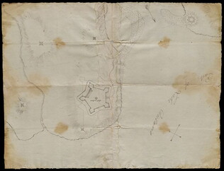
circa 1782-1783
Bauman, Sebastian (1739-1803)
[Map of Forts Ontario and Oswego and surroundings]
Docketed as "A rough sketch of Oswego by Major Bauman." Shows Fort Ontario (captioned), Fort Oswego (uncaptioned) and surrounding features (possibly earthworks).
GLC02437.10667
Showing results 21 - 30