Self-Paced Courses: Explore American history with top historians at your own time and pace!
1780
Barres, Joseph Frederick Wallet des (1722-1824)
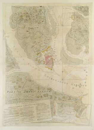
A Sketch of the operations before Charlestown [Charleston, S.C.]....
The key provides detailed military information. Nebenzahl, Battle Plans of the American Revolution, 136.
GLC03103.13
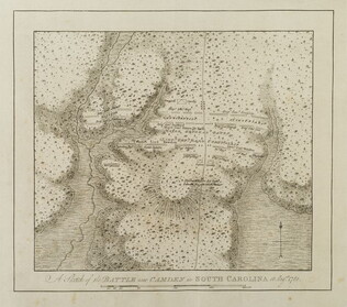
A Sketch of the battle near Camden in South Carolina, August 16, 1780
Nebenzahl, Battle Plans of the American Revolution, 89, who notes that the order of battle is correct while the terrain appears to be inaccurate.
GLC03103.14
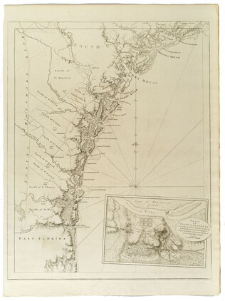
Untitled chart of the coast of Georgia and South Carolina [Savannah]
Includes small plan of the siege of Savannah in a cartouche.
GLC03103.15
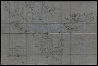
June 1864
Bartelle, Charles V. (fl. 1864)
Sketch showing defences and channels of Charleston Harbor.
This document is a map of Charleston Harbor depicting the major waterways and various forts in the area, among these is Fort Sumter. On the map it states that the map has been, "Copied by direction of Rear Admiral J. A. Dahlgren." The water on the...
GLC05919
1957
Smith, Karl, (fl. 1938-1959)
A Map of the United States 1492-1783
One map illustrated by Karl Smith and published by Linweave Quality Papers, and Chicago Paper Company in 1957. The map features the United States as it was from 1492-1783. It includes the borders of the new states at the close of the American...
GLC09861.01
1935
P.W.A. in Action
One map entitled, "P.W.A. in Action," dated 1935. Map consists of an illustration of the United States; including each of 50 states identified by a local Public Works program. Programs mentioned are related to housing, transportation, defense, museum...
GLC09879
Showing results 141 - 146