Self-Paced Courses: Explore American history with top historians at your own time and pace!
no date
Unknown
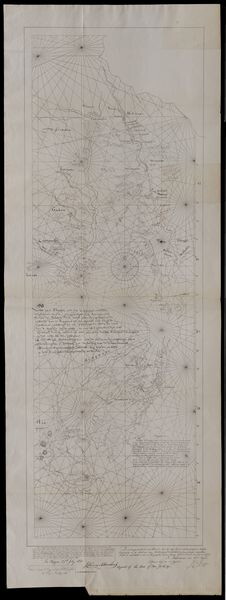
[Survey map of 329.5 acre tract]
Tract broken into three sections. Since this is part of the Duley family papers, the land was probably in Kentucky. Probably circa 1850-1900.
GLC06377.12
1856 ca.
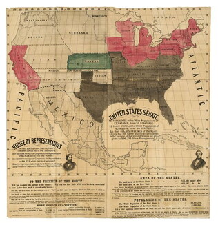
To the free men of the North [election] [large cloth-backed lithographed map]
Free Labor Party abolitionist map used during the 1856 presidential campaign, printed, with hand-coloring in red, black and green.
GLC06662
27 July 1841
Sarony & Co. (1854-1857)
[Facsimile of map of New Netherlands using the names of Native American tribes to indicate location]
Printed on the bottom left corner is the signature of John Romeyn Brodhead, an agent of the State of New York hired to procure and transcribe documents in Europe. Signed by P.H. Loffelt, who copied this document for Brodhead in the Hague, and by J.C...
GLC05859.02
1820/12/24 - 1821/05/28
Gilpin, Sarah Lydia (1802-1894)
Untitled
The author concentrates on family life, but also mentions news items that struck her as important. The entry for January 1 1821 reads, "Rec'd the glorious news of the acquital [sic] of the Queen of England - and the [cession?] of the Floridas to the...
GLC06846.01
1882-1886 circa
Whistler, Simon Mower
[Medical Journal of Simon Mower Whistler]
GLC08362.03
Showing results 21 - 25