Self-Paced Courses: Explore American history with top historians at your own time and pace!
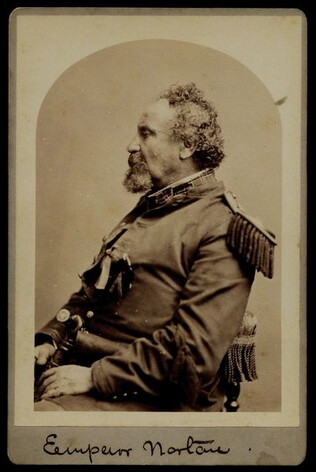
circa 1878
Bradley & Rulofson.
[Cabinet photograph of Joshua Abraham Norton]
Signed "Emperor Norton." Three-quarter profile photograph of a seated Norton. He is wearing an officer's uniform.
GLC02729.01
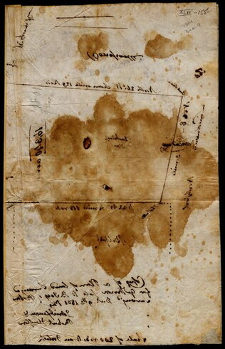
9 December 1801
Gleason, John (fl. 1796-1811)
[Copy of a survey map of land sold by Henry Knox to B. Joy of Boston]
Gleason and Robert Houston sign as surveyors. Depicts 16,340 acres of Waldo Patent land flanked by these notations: "Green, Waldo Heirs, Knox, Belfast, Northport, Lincolnville, and Bonapartte." A list of names is written in pencil within the area...
GLC02437.10341
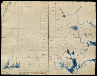
1792
Pierpont, Joseph (fl. 1792)
[Map of land]
Map of the land by the Penobscot River. Water is drawn with blue watercolor ink. Shows the division of land into different plots.
GLC02437.10593
1846
Mitchell, Augustus S. (fl. 1846)
Map of Texas, Oregon and California [pocket atlas]
Full title: A New Map of Texas, Oregon and California with the Regions Adjoining. Compiled from the Most Recent Authorities. First printing of this landmark map of the American West. Baughman, Kansas in Maps, p. 35. Graff 2841. Howes M685. Martin &...
GLC02130
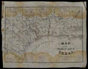
1833 ca.
Meiser, Edward S. (fl. 1833)
Map of the southern part of Texas
Map which belonged to Anthony Dey, a chief figure in the Galveston Bay & Texas Land Co. The map has had lands owned by the Company outlined in ink. Date inferred from provenance. Streeter, Texas 1137A and Philips Maps p. 843.
GLC02754
Showing results 1 - 5