Self-Paced Courses: Explore American history with top historians at your own time and pace!
1792
Ellicott, Andrew (fl. 1792)
[Map of Washington, D.C.].
Engraved folding map removed from the "Columbian Magazine." Included with a letter from Thomas Jefferson to Charles W. Dumas (GLC07104.01).
GLC07104.02
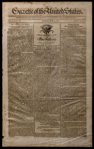
19 June 1790
Gazette of the United States. [Vol. 2, no.20 (June 19, 1790)]
Whole no. 124. re: Notice of Rhode Island's ratification of the Constitution; Washington's letter to Hebrew Congregation of Savannah; etc.
GLC07270
1870? ca.
Porter, Fitz-John
Maps accompanying the proceedings of...the case of Fitz-John Porter [Atlas]
23 maps of Second Bull Run.
GLC07422
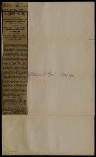
1890/01/11
Tucker, Ada M.
Cleveland Leader.
incomplete newspaper clipping recounting the plans for transporting Jefferson Davis to Washington. Published shortly after Davis's death.
GLC07642.17
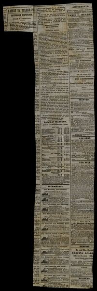
7 February 1862
Cincinnati Gazette
[Detailed report of Union Victory at Fort Henry, Tenn.]
Detailed report of Union victory at Fort Henry, Tenn. Includes three clippings: "Union Flag Planted on Tennsesse Soil;" "Rebel Scouts Captured-Occupation at Romeny;" and "Our Troops in Pursuit of the Rebel Refugees from Fort Henry-The Rebel Troops...
GLC07687.182
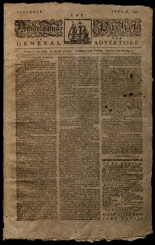
26 June 1779
[The Pennsylvania Packet].
Includes "Dr. Morgan's Vindication," supported by Washington, and a list of those wanted for high treason.
GLC08209
21 September 1907
Army and Navy Register Publishing Company (1879-1948)
Army and Navy Register [Vol. 42, no. 1449 (September 21, 1907)]
Most of this issue it taken up with an obituary of Rear Admiral John G. Walker titled "Death of Rear Admiral Walker." It includes a large photograph of Walker in his dress uniform with a very large mustache. Obit says his ashes will be buried in...
GLC03804.43
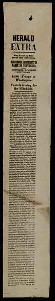
23 April 1861
Unknown
Herald Extra. [(April 23, 1861)]
Headlines reads, "Very latest by telegraph his afternoon. Rebellious excitement in Maryland and Virginia. Northern students sent home. 14000 troops at Washington. Vessels arming for the Blockade." Reports on various events related to the 19 April...
GLC03838
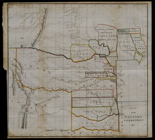
20 May 1834
United States. Congress. House.
Map of the Western Territory & c.
Large folding map of present-day Oklahoma with borders outlined in watercolour designating areas occupied by Native American tribes. Map was previously bound in back of the House Report found in 4132.01. Border lines are colored in blue, yellow...
GLC04132.02
circa 1864
Bacon & Co. (fl. 1864)
Bacon's Large Print War Map Showing 50 Miles round Washington and Richmond
Shows major towns, waterways, and railroads. Concentric circles with intervals of ten miles each surround both Washington and Richmond. A red line shows General Ulysses S. Grant's route from Fredericksburg to Petersburg, Virginia, and a blue line...
GLC04175
Showing results 41 - 50