Self-Paced Courses: Explore American history with top historians at your own time and pace!
1775
Montrésor, John (1736-1799)
A Plan of the City of New York & its environs
Actual title: "A Plan of the City of New-York & its environs..." Shows Manhattan Island up to Greenwich Village. Hand colored.
GLC04315
3 August 1781
Lincoln, Benjamin (1733-1810)
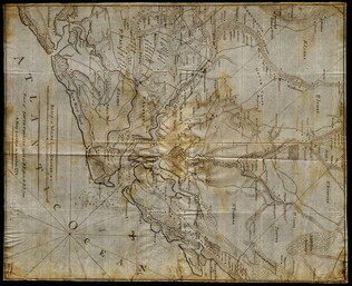
[Map of Charleston, South Carolina]
Manuscript map of Charleston, South Carolina showing the coastline, various rivers and geographic features, certain structures and county names. Date and creator inferred, based on the presumption that this map accompanies GLC02437.01112.
GLC02437.01113
circa 1782
Erskine, Robert (1735-1780)
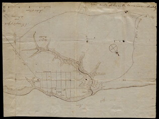
[Map of South Carolina]
A manuscript copy of a printed map of a portion of South Carolina. Shows lakes, rivers, streams, forest, towns, counties, and possibly roads. Noted, "Part of SOUTH CAROLINA copied by R. Erskine F. R. S. from A Map published in London 1771." Docket...
GLC02437.10611
1780-1781
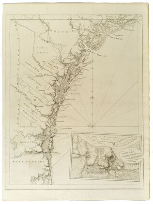
Barres, Joseph Frederick Wallet des (1722-1824)
The Atlantic Neptune [selected maps and charts]
GLC03103
October 1781
Unknown
[Map of Yorktown, Virginia]
Drawn map of Yorktown, Virginia. Shows roads, rivers, and other land markings, but not fortifications. With Cornwallis autograph note written across the front: "you will deliver the town immediately." Likely created by the British right before the...
GLC02437.10669
1780
Untitled chart of the coast of Georgia and South Carolina [Savannah]
Includes small plan of the siege of Savannah in a cartouche.
GLC03103.15
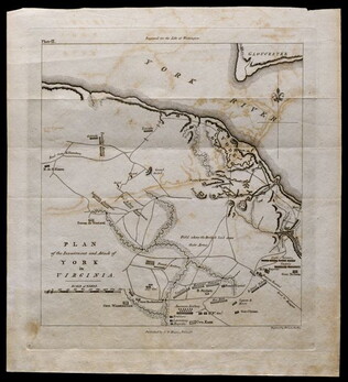
1781, reprint Philadelphia 1807
Plan of the investment and attack of York in Virginia [from Life of Washington]
Plate IX. Shows Yorktown. Published by C. P. Wayne; engraved by Francis Shallus.
GLC04760.02
Showing results 41 - 47