MA in American History: Apply now and enroll in graduate courses with top historians this summer!
1792
Ellicott, Andrew (fl. 1792)
[Map of Washington, D.C.].
Engraved folding map removed from the "Columbian Magazine." Included with a letter from Thomas Jefferson to Charles W. Dumas (GLC07104.01).
GLC07104.02
9 December 1801
Gleason, John (fl. 1796-1811)
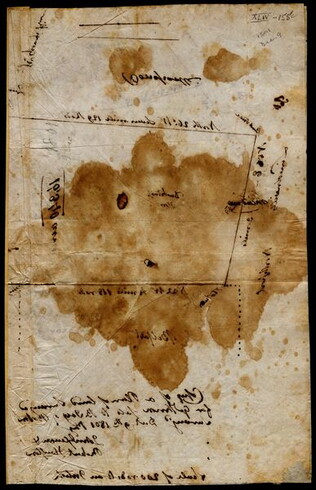
[Copy of a survey map of land sold by Henry Knox to B. Joy of Boston]
Gleason and Robert Houston sign as surveyors. Depicts 16,340 acres of Waldo Patent land flanked by these notations: "Green, Waldo Heirs, Knox, Belfast, Northport, Lincolnville, and Bonapartte." A list of names is written in pencil within the area...
GLC02437.10341
1794/05/14
Whittle & Laurie
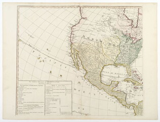
A new and general map of the middle dominion belonging to the United States...
The map shows part of the United States, from western New England to Michigan, and from Vermont to southern Virginia.
GLC04178
1784
Faden, William (ca. 1750-1836)
Plan of the Siege of Savannah...
Nebenzahl, Battle Plans of the American Revolution, 76.
GLC04316
1796/01/01
Arrowsmith, Aaron (fl. 1796)
A Map of the United States of North America
Handcolored. Each sheet is 66 cm high. The map shows the northwest territory outside the Union. A portion of Louisiana is included.
GLC04318
1786/08/15
Sayer, Robert
A Map of the Whole Continent of America... [Wall Map on 4 sheets]
GLC04412.01
1787/01/01
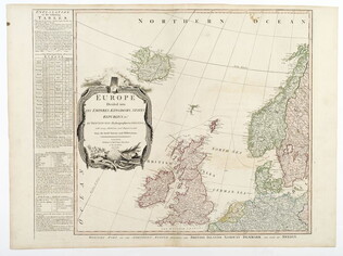
Europe divided into its Empires, Kingdoms, States... [Wall Map on 4 sheets]
This map has an attractive depiction of Algiers and the Barbery states which is slightly larger than that for GLC# 4412.04 (Africa)
GLC04412.02
1787/01/06
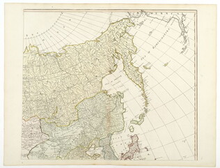
Asia and its islands, according to D'Anville... [Wall Map on 4 sheets]
GLC04412.03
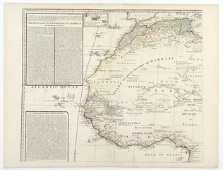
Africa with all its states, kingdoms... by S. Boulton [Wall Map on 4 sheets]
GLC04412.04
Showing results 1 - 9