MA in American History: Apply now and enroll in graduate courses with top historians this summer!
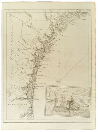
1780
Barres, Joseph Frederick Wallet des (1722-1824)
Untitled chart of the coast of Georgia and South Carolina [Savannah]
Includes small plan of the siege of Savannah in a cartouche.
GLC03103.15
17 August 1900
unkown
Upper Silesia Plebiscite Area
Shows area of developed mineral resources, including coal bearing area. Also includes railways and district boundaries. Red line for final British proposal, Blue for French, and Green for League of Nations lines.
GLC02766.003
Unknown
Upper-Silesian Plebiscite-Area
Final Results of the Plebiscite shown by districts.
GLC02766.009
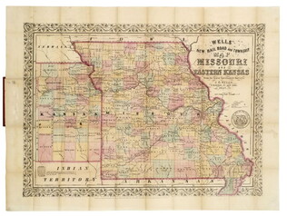
1857
Wells, John G. (John Gaylord) (1821-1880)
Well's new map of Missouri and Eastern Kansas
This is a fold out map contained within a book measuring 14.5 x 9 cm. When unfolded, the full title displayed on the map is "Well's New Railroad and Township Map of Missouri and Eastern Kansas from the latest Government Surveys." Contains a large...
GLC04174
John Tallis & Company
Western Africa
JB00101
1861-1877
Works of Defense Surrounding Rienzi Tishomingo Co. Mississippi
GLC06728.142
WWII Newsmap published by the War Department Bureau of Public Relations
GLC09865
Showing results 261 - 267